
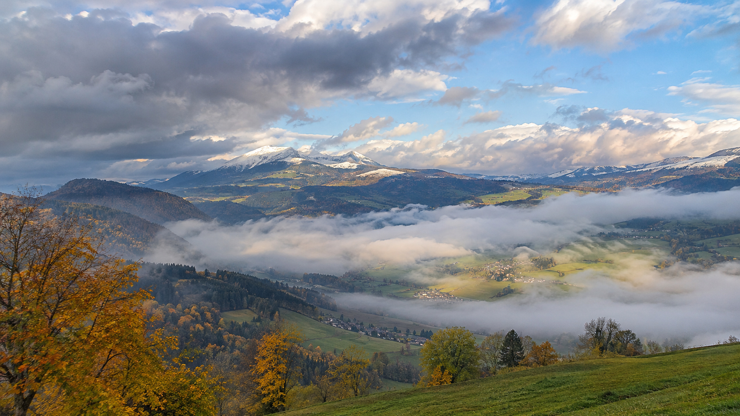
A broad high-pressure pattern remains the dominant feature across much of western and central Europe, but the surface weather is far from uniformly sunny. Cool easterly and northeasterly winds are trapping moisture in valleys and lowlands, while weak disturbances continue to brush northern Germany, northern France and parts of the Mediterranean.
Side by side
Why one high-pressure system can produce opposite weather
High pressure does not automatically mean blue skies everywhere. Stable air can trap moisture near the surface while hills and mountains sit above the low cloud in much clearer air.
- Lowlands and valleysCold, moist air can become trapped close to the ground, producing persistent fog or low cloud.
- Higher groundAbove the stable layer the air is often drier, allowing longer sunny spells and a very different feel.
Central Europe: low cloud below, sunshine above
Switzerland and the western Alps are a textbook example of an early-November inversion pattern. Low cloud and fog cover large parts of the Swiss Plateau, with the cloud top locally between roughly 1,500 and 2,000 metres. Above that layer, the mountains are often sunny. Similar low-cloud conditions affect parts of Austria, where temperatures are low enough for a few snowflakes to reach middle elevations.
Germany is more changeable. A weak trough brings cloud and light rain to northern areas, while southern regions are colder and locally frosty at night. Coastal areas remain breezy in a north to northeasterly flow.
France and Italy show the strongest north-south contrasts
In France, a weak front brings cloud and light rain across the north and northwest on Monday. The southwest and Mediterranean regions are much brighter. Temperatures remain modest, generally in the low to mid teens, with colder nights inland.
Italy has the opposite contrast. Northern regions are mostly dry and brighter, but southern and Adriatic areas remain unsettled with rain, thunderstorms and strong winds on Monday. Conditions improve during Tuesday as the low-pressure system gradually loses its influence.
Tuesday: little large-scale change
Good to know
Why fog is often the hardest part of the forecast
Autumn fog can change over short distances and sometimes clears much earlier or later than expected. Small changes in wind and mixing can completely alter local conditions.
- Local effects matterValleys, rivers, soil moisture and nearby hills strongly influence where fog first forms and how long it lasts.
- Wind can change everythingA little more mixing may break up low cloud, while calm conditions can allow it to persist well into the day.
By Tuesday evening, high pressure is still controlling much of western and central Europe. That means the main weather story is not a major Atlantic storm, but persistent low cloud, cold nights and regional showers around the edges of the high. Mountain areas continue to enjoy the best sunshine where they rise above the inversion layer.